Accueil » Cartes et planisphères par thématique » Carte du monde : surface forestière par État (km²)
Carte du monde : surface forestière par État (km²)
© Atlasocio.com
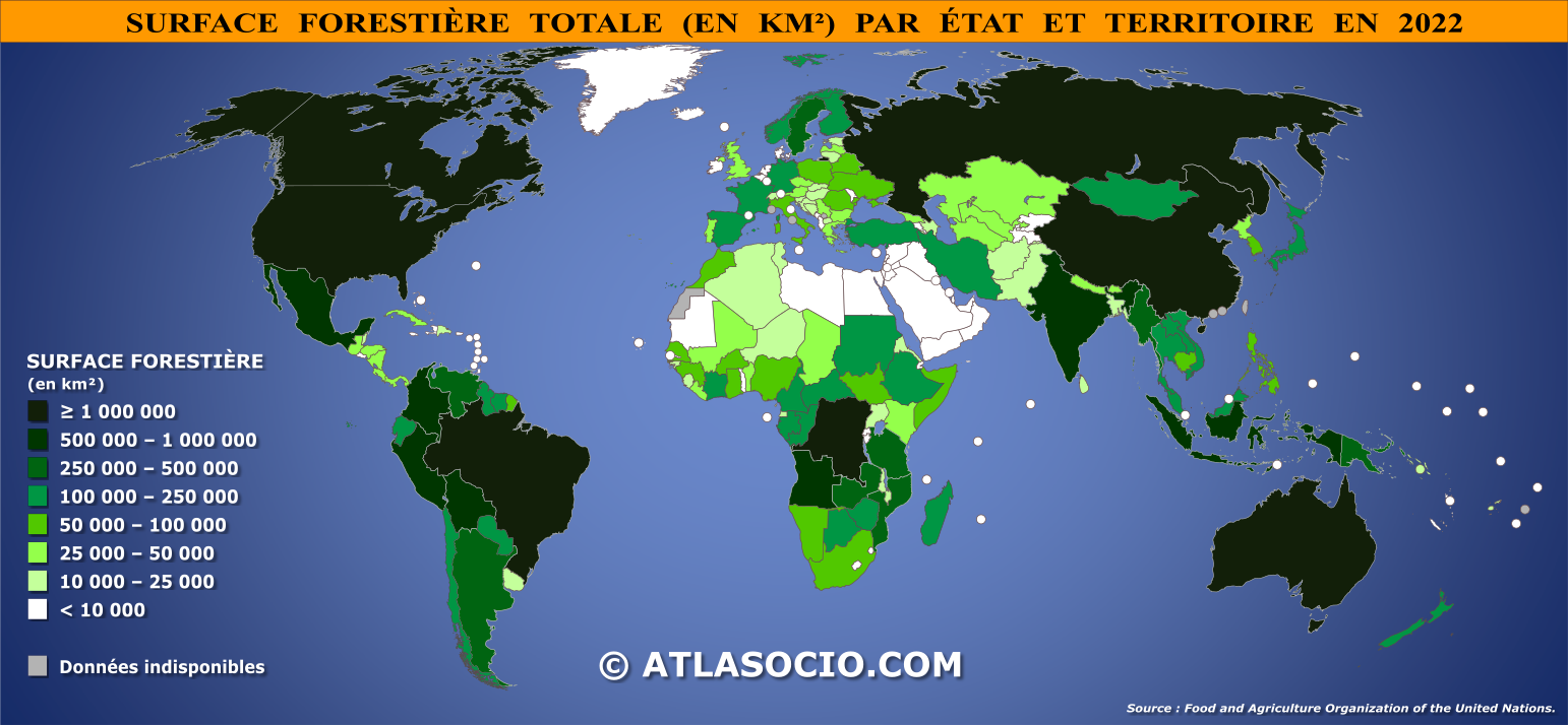
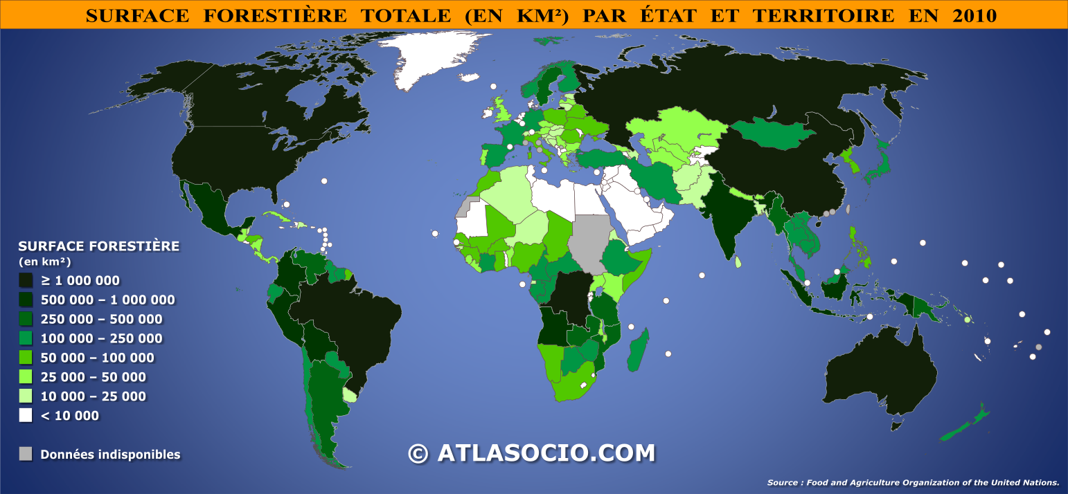
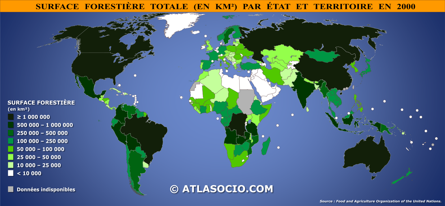
Carte du monde relative à la surface forestière par État, exprimée en kilomètre carré, soit les régions boisées naturelles ou plantées abritant des arbres d’au moins 5 mètres in situ, qu’elles soient productives ou pas, à l'exclusion des parcs et jardins urbains.
Les forêts couvrent une part significative de la surface terrestre et jouent un rôle essentiel dans la régulation du climat, la biodiversité et les cycles hydrologiques. La répartition de la surface forestière varie considérablement d'un État à l'autre, en fonction de facteurs climatiques, géographiques et socio-économiques. Certaines nations, comme le Brésil, la Russie ou le Canada, possèdent des étendues forestières vastes, tandis que d'autres présentent des superficies boisées plus restreintes en raison de contraintes naturelles ou d'une forte anthropisation du territoire. La cartographie mondiale de la surface forestière par État permet ainsi de visualiser ces disparités et d’analyser les dynamiques qui influencent l’évolution des écosystèmes forestiers.
L'élaboration d’une telle carte repose sur l’agrégation de données issues d’imageries satellitaires, de relevés géospatiaux et de statistiques nationales. Ces informations permettent d’évaluer les tendances de la déforestation, de la reforestation et de la préservation des zones boisées, fournissant ainsi des indications précieuses pour la gestion durable des forêts. La comparaison entre États permet une analyse des politiques environnementales adoptées et leur efficacité dans la préservation des écosystèmes.
- ▶ VOIR AUSSI :
- – Classement des États par surface forestière totale (km²)
- – Cartes du monde relatives à la surface forestière par État (% du territoire)
- – Cartes du monde relatives à l'évolution de la surface forestière par État (km²)
- – Cartes du monde relatives à l'évolution de la surface forestière par État (% du territoire)
Cartes du monde relatives à la surface forestière par État (km²)
Source : Food and Agriculture Organization of the United Nations.